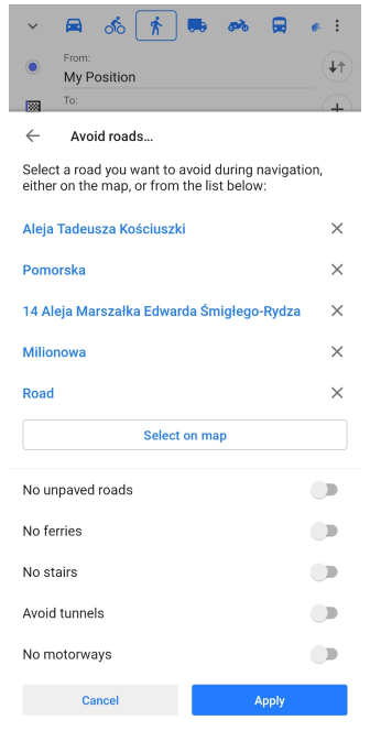
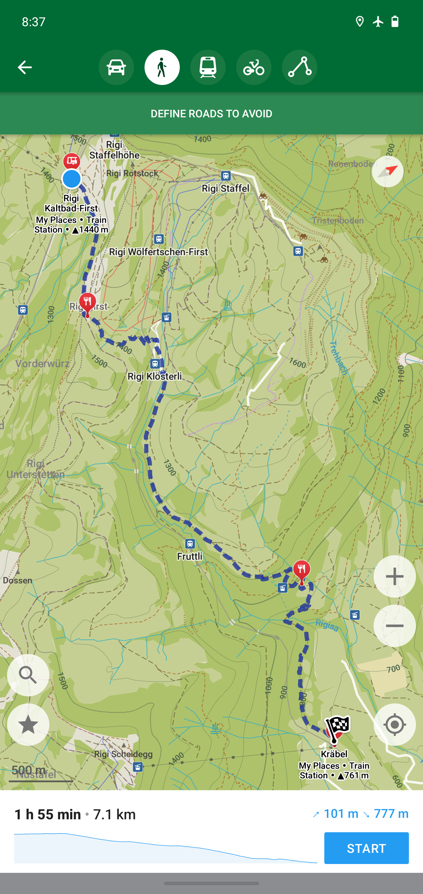
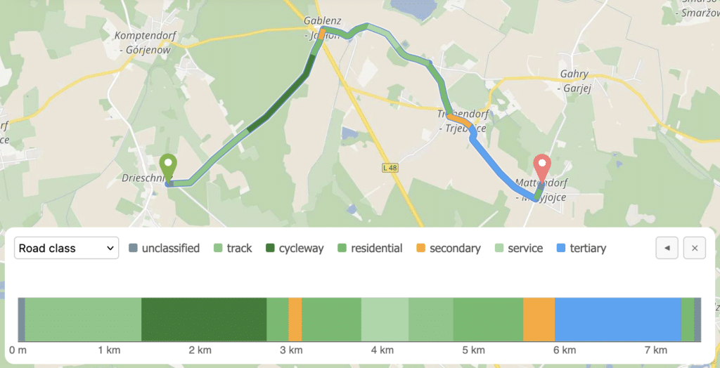
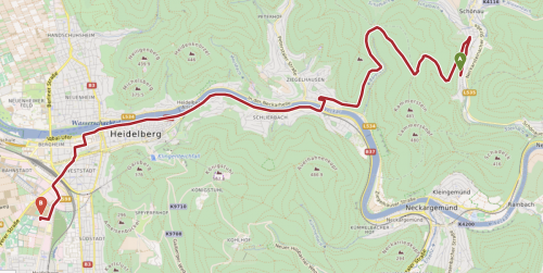
aboutOSMContentaboutOSMContentaboutOSMContent NOTE: This website is still a work in progress, please check back. aboutOSMContentaboutOSMContentaboutOSMContent NOTE: This website is still a work in progress, please check back.
Navigation & Location Services

Mapping every corner of the world, together.

Discover how OpenStreetMap powers navigation and location services worldwide—guiding people through maps made by people like you.

The Map that Guides the World

What This Means

As populations expand and new places emerge—from unmapped villages to rapidly growing cities—developers and users need accurate, reliable location data to build services that truly work everywhere. OpenStreetMap, with its open data and global community, fills critical navigation gaps where commercial map providers fall short. Powered by volunteers and supported by technology organizations, OSM enables app developers, businesses, and everyday users to deliver and experience seamless, trustworthy location services with confidence.

How OSM has been contributing to better navigation and location services

Komoot for iPhone

The Komoot iPhone app uses OpenStreetMap (OSM) data for map display and routing. It allows users to plan bike, hiking, and outdoor tours using OSM’s open geospatial database. Users can navigate routes, track activity, and, where supported, upload GPS tracks back into OSM, enhancing the underlying map data.

Komoot for iPhone

Apple Maps / Apple on OpenStreetMap Wiki

Apple’s historical and regional use of OSM data. Apple has incorporated OpenStreetMap map tiles and geodata in its maps for some regions and applications since 2012. Apple’s mapping teams also contribute edits back to OSM, supporting global mapping coverage and improvements.

Apple Maps / Apple on OpenStreetMap Wiki

Launching the Facebook Mapping Platform with OpenStreetMap

The Facebook global map project was built using OpenStreetMap (OSM) as its primary data source. Stamen partnered with Facebook engineers to design an open, scalable base map emphasizing community and local features. OSM data underpins global roads, parks, and landmarks, allowing Facebook to serve rich interactive maps for billions of users

Launching the Facebook Mapping Platform with OpenStreetMap

Pokémon Go Switches from Google Maps to OpenStreetMap

In 2017 Niantic, the developer of Pokémon GO, replaced the game’s in-world map provider and base map data from Google Maps to OpenStreetMap (OSM). Before that change, Google Maps powered the visual map display while OSM data was occasionally used in background systems like spawn point logic.

Pokémon Go Switches from Google Maps to OpenStreetMap

Apple, Foursquare Ditch Google Maps for OpenStreetMap

In 2012, Apple and Foursquare moved away from Google Maps toward OpenStreetMap to reduce costs, gain independence, and customize mapping features. The shift highlighted dissatisfaction with Google’s licensing limits. OpenStreetMap provided Apple with local street and point-of-interest details, especially in countries or areas where proprietary data was lacking

Apple, Foursquare Ditch Google Maps for OpenStreetMap

Craigslist Baby-Steps Into Modernity

In response to Google Maps API price hikes in 2012, several prominent web platforms migrated to OpenStreetMap. Craigslist, the popular classifieds site, began embedding OSM-based maps on housing listings (starting in SF and Portland) to show locations and save on fees.

Craigslist Baby-Steps Into Modernity

How you can contribute

You don't need a cape or a degree to save lives—just a mouse and a little heart .❤️

Join the HOT Tasking Manager

Help map areas in crisis and support real-time response.

Get Started

Learn mapping with LearnOSM

Step-by-step guides for beginner to expert.

Get Started

Donate to Humanitarian OSM Team (HOT)

Support mapping for disaster response worldwide.

Learn More